Cape Kamui
Kamui Misaki · Cape Kamui Shakotan · 神威岬
overview
What this place is
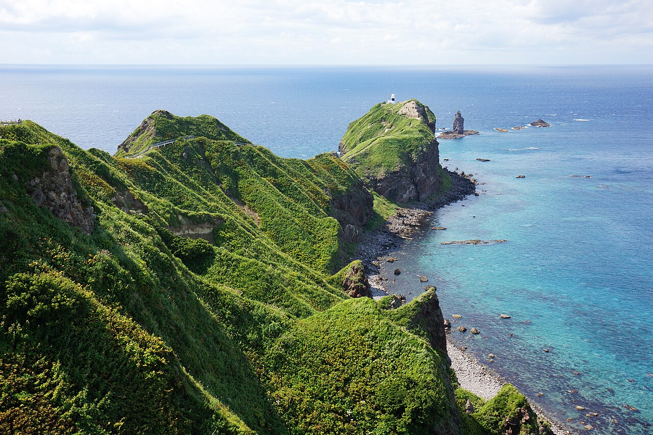
Cape Kamui reaches out from Shakotan Town, Hokkaido, about 80 metres above the sea. A narrow path runs along the ridge to the tip, where the horizon opens out across roughly 300 degrees over the blue water known as Shakotan blue. The rock offshore is Kamui-iwa.
- A cape standing about 80 metres above the sea
- A horizon opening across roughly 300 degrees from the tip
- The water known as Shakotan blue
- Kamui-iwa, the rock seen offshore from the tip
plan your visit
Visit facts for Cape Kamui
- Access
- About 70 minutes by car from JR Yoichi Station, following the Hokkaido tourism guidance. Check the last entry at the cape gate, your return journey, and whether the gate is closed for wind before you set out.
- Nearest station
- JR Yoichi Station (then by car)
- Hours
- The Cape Kamui natural park opens on a monthly schedule. The gate to the tip opened on 10 April 2026, but it closes at any time in strong wind and similar conditions. Last entry is generally one hour before closing; follow the latest Shakotan Town notice on the nature trails.
- Fees
- Entry is free. Transport, food, and nearby facilities are separate.
- Parking
- Available in Japanese only: 無料駐車場約200台。ゲート閉鎖、満車、冬季、早期閉園時は進入しない。
- Typical visit
- About 100 minutes (Unmeguri's estimate, not an official figure)
- Facts checked
- 2026-10-22
background
Central feature
The cape and its ridge path · Kamui-iwa offshore
The Hokkaido tourism organisation describes a cape about 80 metres high from which the horizon opens across roughly 300 degrees. The official Hokkaido tourism site presents Cape Kamui as a landscape that carries Ainu cultural and historical context.
etiquette
Visiting with respect
- The path to the tip runs along a ridge with height changes, steps, narrow sections, and strong wind. Treat viewing from the car park and gate area as a different visit from walking out to the tip.
- The gate closes without notice in strong wind. Do not pass a closure notice, and allow for the walk back.
- Ask Shakotan Town in advance about how far you can go using a wheelchair or similar.
- Hours, fees and reception can change; check the official information before you go.
faq
Common questions
How do I get to Cape Kamui?
About 70 minutes by car from JR Yoichi Station, following the Hokkaido tourism guidance. Check the last entry at the cape gate, your return journey, and whether the gate is closed for wind before you set out. Nearest station: JR Yoichi Station (then by car).
How much does it cost to visit Cape Kamui?
Entry is free. Transport, food, and nearby facilities are separate.
What are the opening hours of Cape Kamui?
The Cape Kamui natural park opens on a monthly schedule. The gate to the tip opened on 10 April 2026, but it closes at any time in strong wind and similar conditions. Last entry is generally one hour before closing; follow the latest Shakotan Town notice on the nature trails.
Is there parking at Cape Kamui?
Parking information for Cape Kamui is available in Japanese only: 無料駐車場約200台。ゲート閉鎖、満車、冬季、早期閉園時は進入しない。
How long should I spend at Cape Kamui?
Unmeguri's estimate for a visit is about 100 minutes. This is an editorial estimate, not an official figure.
Can I always walk to the tip?
No. The gate to the tip closes at any time in strong wind and similar conditions, and last entry is generally one hour before closing. Check the latest Shakotan Town notice.
How long is the walk?
The walk to the tip takes around 35 minutes each way along a ridge path with height changes, steps, and narrow sections.
sources
Sources and checked dates
- 神威岬|北海道観光公式サイト(opens in a new tab)
- 自然遊歩道の開放状況(2026年)|積丹町(opens in a new tab)
- 神威岬自然公園の開園時間|積丹町(opens in a new tab)
- 神威岬自然公園の開園時間・利用ルール|積丹町(opens in a new tab)
Facts last checked on 2026-10-22. Sources are in Japanese. Unmeguri separates officially documented facts from its own editorial reading, and does not promise that any wish or outcome will be realized.