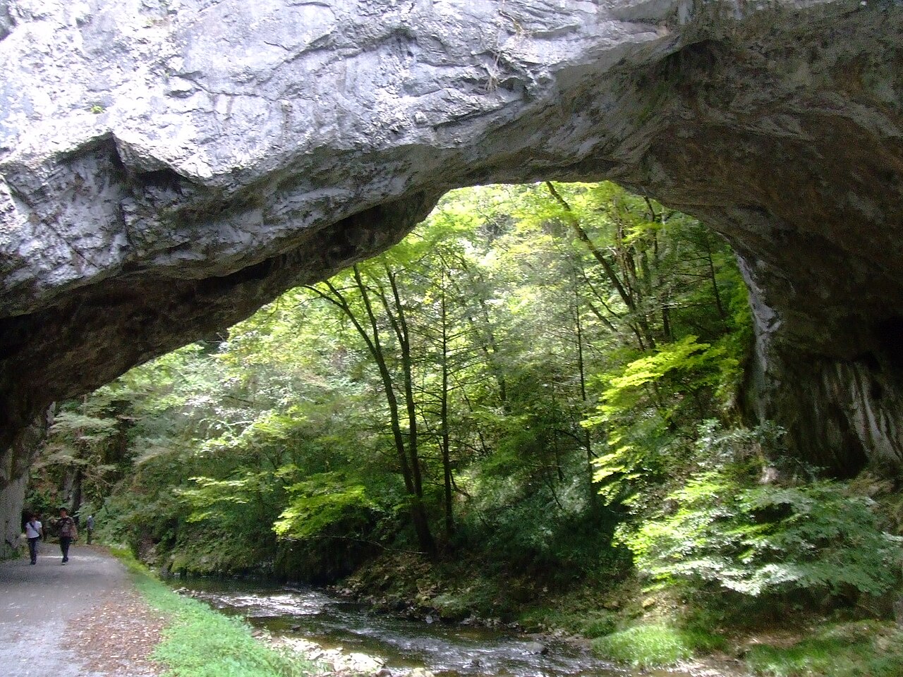
Taishakukyo Gorge
帝釈峡 · Taishaku Gorge · Taishaku-kyo
overview
What this place is
Taishakukyo is a limestone gorge of about 18 kilometers spanning Shobara and Jinsekikogen in the mountains of eastern Hiroshima, designated a national Place of Scenic Beauty. Long erosion of a karst plateau has shaped ravines, caves, a natural bridge, and the lake Shinryuko. As of July 2026, the path near the Onbashi natural bridge is closed because of rockfall and the bridge cannot be viewed, so check which areas — such as Lake Shinryu and the Hakuundo cave — are open on the day.
- A limestone gorge of about 18 kilometers, designated a national Place of Scenic Beauty
- Karst scenery of ravines and caves shaped by the long erosion of a limestone plateau
- Lake Shinryu (Shinryuko), a lake area separate from the upper gorge
- The Hakuundo limestone cave in the upper gorge area
plan your visit
Visit facts for Taishakukyo Gorge
- Access
- Transport from Tojo Station on the JR Geibi Line to the upper gorge area takes about 25 minutes and varies by season and day of the week; check taxi and local services along with your return leg in advance, and treat the Lake Shinryu side as a separate trip.
- Nearest station
- Taishaku bus stop (Bihoku Kotsu)
- Hours
- As of July 2026, the path from near the Onbashi bridge to Oni-no-Karamon is closed because of rockfall, and the Onbashi natural bridge cannot be viewed; recovery is expected to take a long time. Check the latest official information for the areas that are open, such as Lake Shinryu and the Hakuundo cave.
- Fees
- Walking in the gorge is free as a rule, while the Hakuundo cave, sightseeing boats, parking, and activities are charged separately. No ticket or tour gives access to the closed section.
- Parking
- Available in Japanese only: 各区域の公式駐車場を利用し、通行止めゲート、林道、私有地、緊急車両動線へ駐車しません。
- Typical visit
- About 100 minutes (Unmeguri's estimate, not an official figure)
- Facts checked
- 2026-10-22
background
Central feature
The limestone gorge and the Lake Shinryu scenery
Public tourism information explains that a limestone karst plateau was eroded over a long span of time, forming the gorge together with its caves, a natural bridge, and the lake.
etiquette
Visiting with respect
- Do not enter the closed section between the Onbashi area and Oni-no-Karamon, or go around gates, fences, ropes, or slopes to bypass it.
- Do not collect rocks, fossils, or plants, and follow the operators' safety instructions and weather decisions at the cave, at the waterside, and on the sightseeing boats.
- The upper gorge and Lake Shinryu are separate areas; choose one open area for the day rather than forcing both into a single trip.
- Hours, fees and reception can change; check the official information before you go.
faq
Common questions
How do I get to Taishakukyo Gorge?
Transport from Tojo Station on the JR Geibi Line to the upper gorge area takes about 25 minutes and varies by season and day of the week; check taxi and local services along with your return leg in advance, and treat the Lake Shinryu side as a separate trip. Nearest station: Taishaku bus stop (Bihoku Kotsu).
How much does it cost to visit Taishakukyo Gorge?
Walking in the gorge is free as a rule, while the Hakuundo cave, sightseeing boats, parking, and activities are charged separately. No ticket or tour gives access to the closed section.
What are the opening hours of Taishakukyo Gorge?
As of July 2026, the path from near the Onbashi bridge to Oni-no-Karamon is closed because of rockfall, and the Onbashi natural bridge cannot be viewed; recovery is expected to take a long time. Check the latest official information for the areas that are open, such as Lake Shinryu and the Hakuundo cave.
Is there parking at Taishakukyo Gorge?
Parking information for Taishakukyo Gorge is available in Japanese only: 各区域の公式駐車場を利用し、通行止めゲート、林道、私有地、緊急車両動線へ駐車しません。
How long should I spend at Taishakukyo Gorge?
Unmeguri's estimate for a visit is about 100 minutes. This is an editorial estimate, not an official figure.
Can I see the Onbashi natural bridge?
Not at present. As of July 2026 the path near the bridge is closed because of rockfall and the bridge cannot be viewed; recovery is expected to take a long time, so check the latest official information.
sources
Sources and checked dates
- 上帝釈峡の通行規制|広島県(opens in a new tab)
- 雄橋周辺の通行止め|休暇村帝釈峡(opens in a new tab)
- 帝釈峡|ひろしま公式観光サイト(opens in a new tab)
Facts last checked on 2026-10-22. Sources are in Japanese. Unmeguri separates officially documented facts from its own editorial reading, and does not promise that any wish or outcome will be realized.